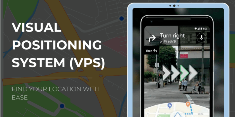
Have you ever used a map-to figure out where you are and where you need to go? Well, a Visual positioning system (VPS) is a kind of map or precisely a navigation and positioning technology that makes use camera of the user’s smartphone to recognize their surroundings, and then graphically show directions on the screen of the phone, such as lit-up arrow and detailed steps.
With a VPS, you can use your device to get directions and find things like stores, restaurant, and other places around you. It’s similar to having a virtual tour guide who can direct you.
Till a few year ago people were dependent on passers-by for directions to reach an unknown destination until GPS was launched by Google Maps, a technology by that changed the way of finding directions.
But many people still struggle to navigate correctly and are left wondering as, “Where precisely am I, and which way is west? The Google Maps had challenges with accuracy and direction as assistance via GPS alone is limited in dense metropolitan areas.
GPS determines a precise location by measuring the delay of radio transmissions from numerous dedicated satellites. But, because to low visibility in the sky and signals reflecting off of buildings, locating a geographic position in corwded metropolitan environmnents can be extremely difficult. And due to this it produces inaccurate location information.
to improve the precision of location and direction on the map, Google developed VPS, which enables the camera on a mobile device to orient itself in a manner similar to how users would do.
How does Google's VPS work?
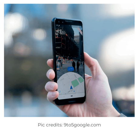
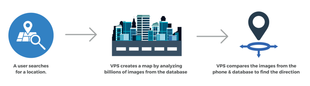
VPS determines location and direction using images rather than GPS satellite signals. Whenever a user search for a location in the Google Maps the VPS first generates a map by evaluating a sequence of photos with known locations for key visual features. The VPS database and the features in ht images from the smartphone are comapared in order to locate and find accurate direction.
However, the accuracy of the location and direction through VPS is highly dependent on the quality of the both the images and the location associated with it. Hence, Google Maps has integrated VPS with its “Street View” feature. The Street View feature offers billions of panoramic images to provide a virtual representation of our surroundings on Google Maps. Street View’s extensive dataset offers biilions of reliable reference point that can be used to identify location and navigate people to their destination more precisely.
How inclusion of AR will enhance VPS?
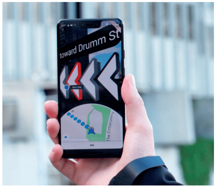
Google has revealed intentions to incorporate a new feature of Augmented Reality. The organization has tested using Google’s platform for augmented reality experiences, “ARCore”, to display direction directly over Google Maps while a user is using the walking navigation feature.
With the Addition of this feature, user may quickly glance at their phones to see precisely which direction they should go in. But, as fascinating as it appears, it is equally difficult to develop. The developers have a challenge of making this technology to work everywhere and in all type of climatic conditions. Currently, this feature has been rolled out in some parts of U.S and Japan such as Chicago, Long Island, New York, Los Angeles, New Jersey, San Francisco, California and Tokyo.
Patent activity around VPS
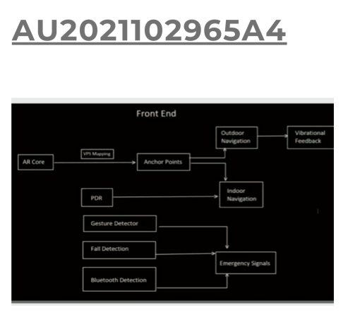
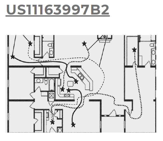
Title: A visual positioning system
Filling Date: 2021-05-29
Assignee: Vishwakarma Institute of Information Technology
The patent elaborates about the field of AI and, in particular, a visual positioning system that blind people can utilize to navigate independently.
Title: Camera calibration for localization
Filing Date: 2021-12-09
Assignee: Here Global BV
The patent elaborates about a real-time camera calibration for use in the image-based visual positioning system. The innovation aims to improve the accuracy to locate a place.
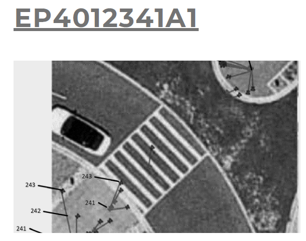
Title: Systems & methods for visual positioning
Filing Date: 2022-06-18
Assignee: Beijing Didi Infinity Technology
The patent elaborates about a visual positioning method the location is determined by 3D point cloud map associated with that area.
Title: Transitioning between map view & AR view
Filing Date: 2018-02-23
Assignee: Google LLC
The patent elaborates about switching between a map view and an augmented reality (AR) view. The aim of the innovation is offer hassle-free transitioning.
Title: Visual navigation for mobile devices operable in differing environmental lighting conditions
Filing Date: 2019-07-15
Assignee: Labrador Systems Inc
The patent elaborates about a visual positioning system for mobile devices. The aim of the innovation is to navigate across a various environmental conditions.
Key Takeaways
Visual Position System could be a game changer in the near future as VPS is more accurate and user-friendly that GPS. Users are more likely to get lost when using GPS to find the appropriate directions, however this is not the case with VPS due to its visual map generation.
Google has been influential in the development of the VPS, which uses the user’s phone camera to help people rapidly identify which way to walk.
The future of VPS may see more augmented reality technology integrated into the navigation system to make the path finding more intuitive and engaging.